Our Services
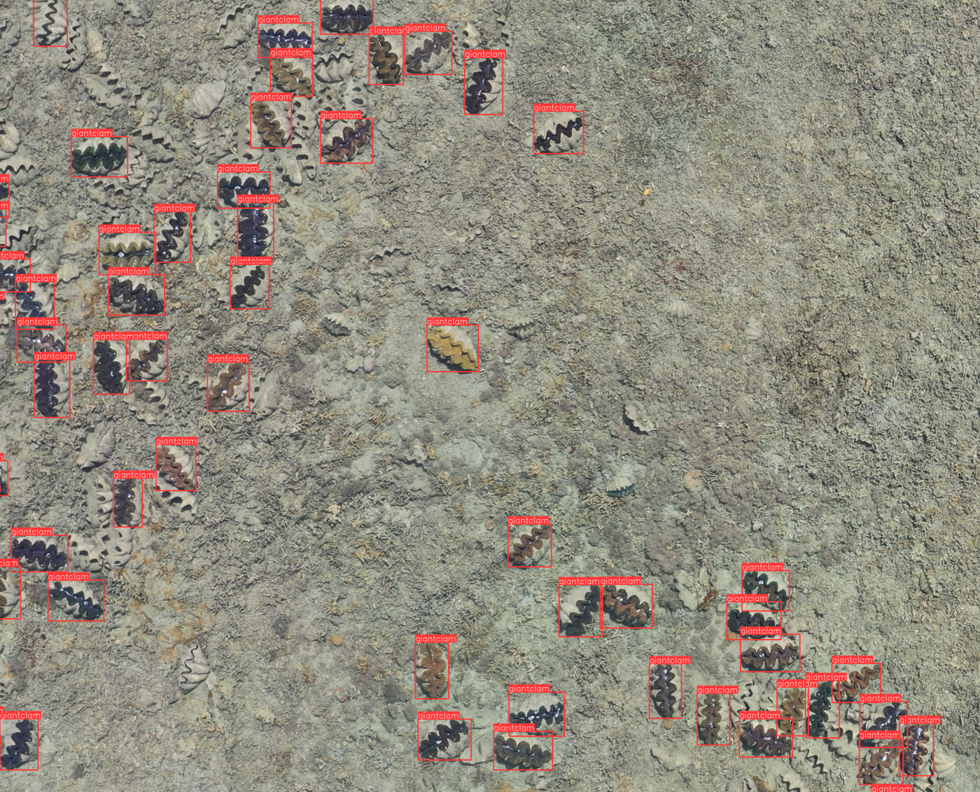
Custom Object Detection
Leverage cutting-edge AI technology to automatically identify and count objects from aerial imagery. Perfect for surveying infrastructure, monitoring assets, tracking wildlife populations & invasive weeds, or detecting changes across large areas.
Our custom-trained models can identify virtually any object of interest, saving countless hours of manual inspection and providing accurate, repeatable results for your surveying needs.
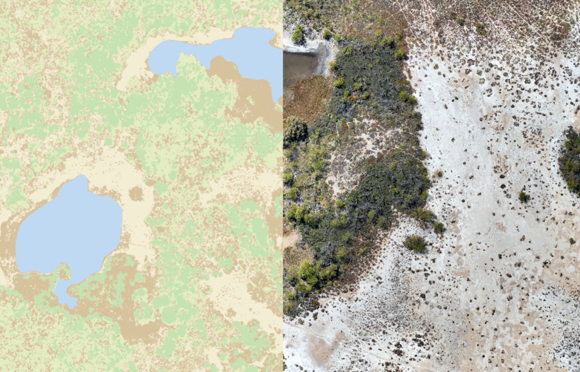
Land Classification
Advanced pixel-based classification to map and categorize land cover types from aerial and satellite imagery. Essential for environmental monitoring, agricultural surveys, urban planning, and change detection.
Our machine learning algorithms accurately distinguish between vegetation types, water bodies, built environments, and soil conditions, providing detailed land use maps that support informed decision-making for surveying and planning projects.
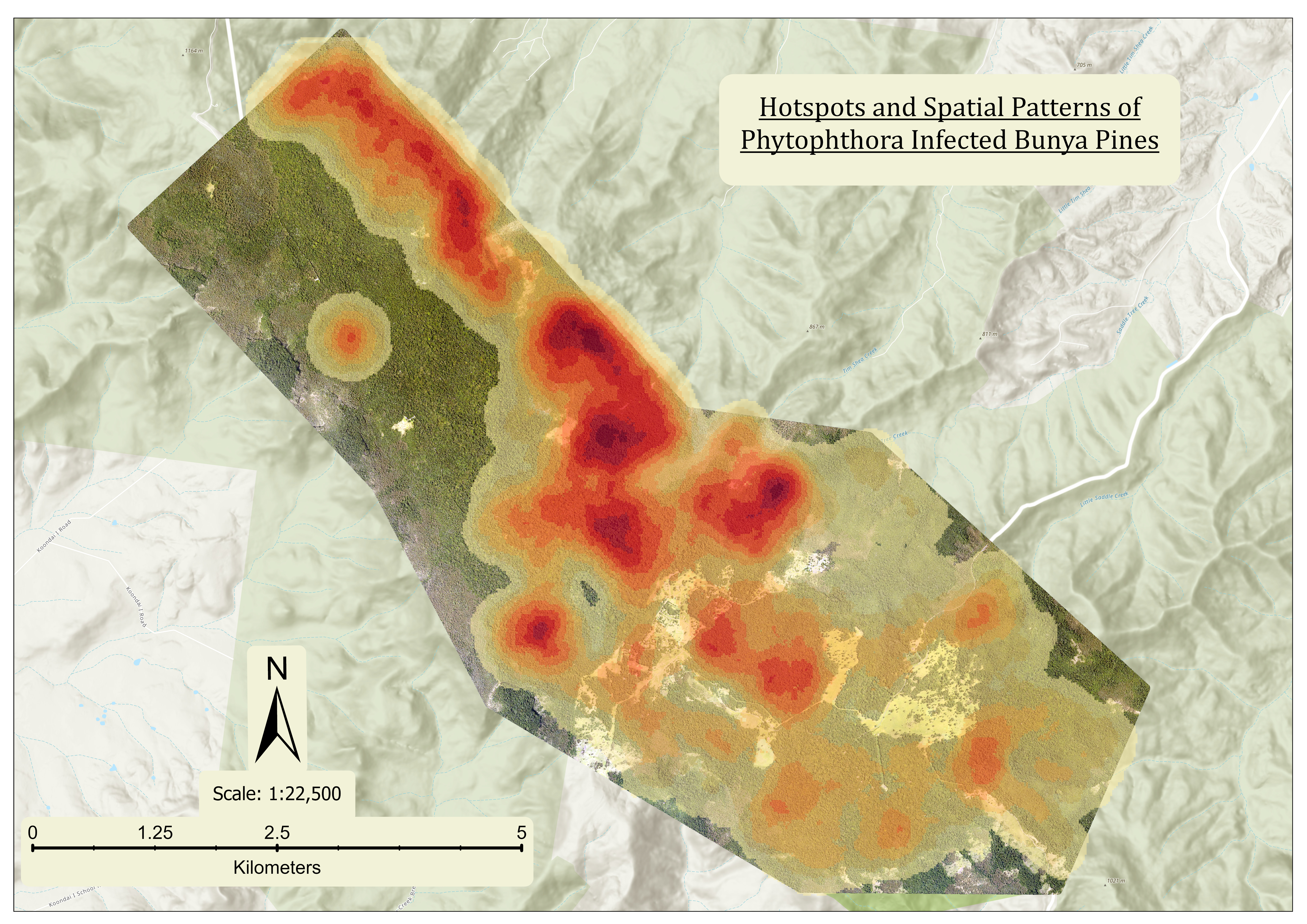
General Geospatial Analytics
Comprehensive GIS analysis services including spatial pattern analysis, terrain modeling, and data visualization. We create kernel density maps, perform buffer analysis, conduct viewshed studies, and deliver actionable insights from your geographic data.
Whether you need environmental impact assessments, site selection analysis, or demographic studies, our expertise transforms raw spatial data into strategic intelligence.
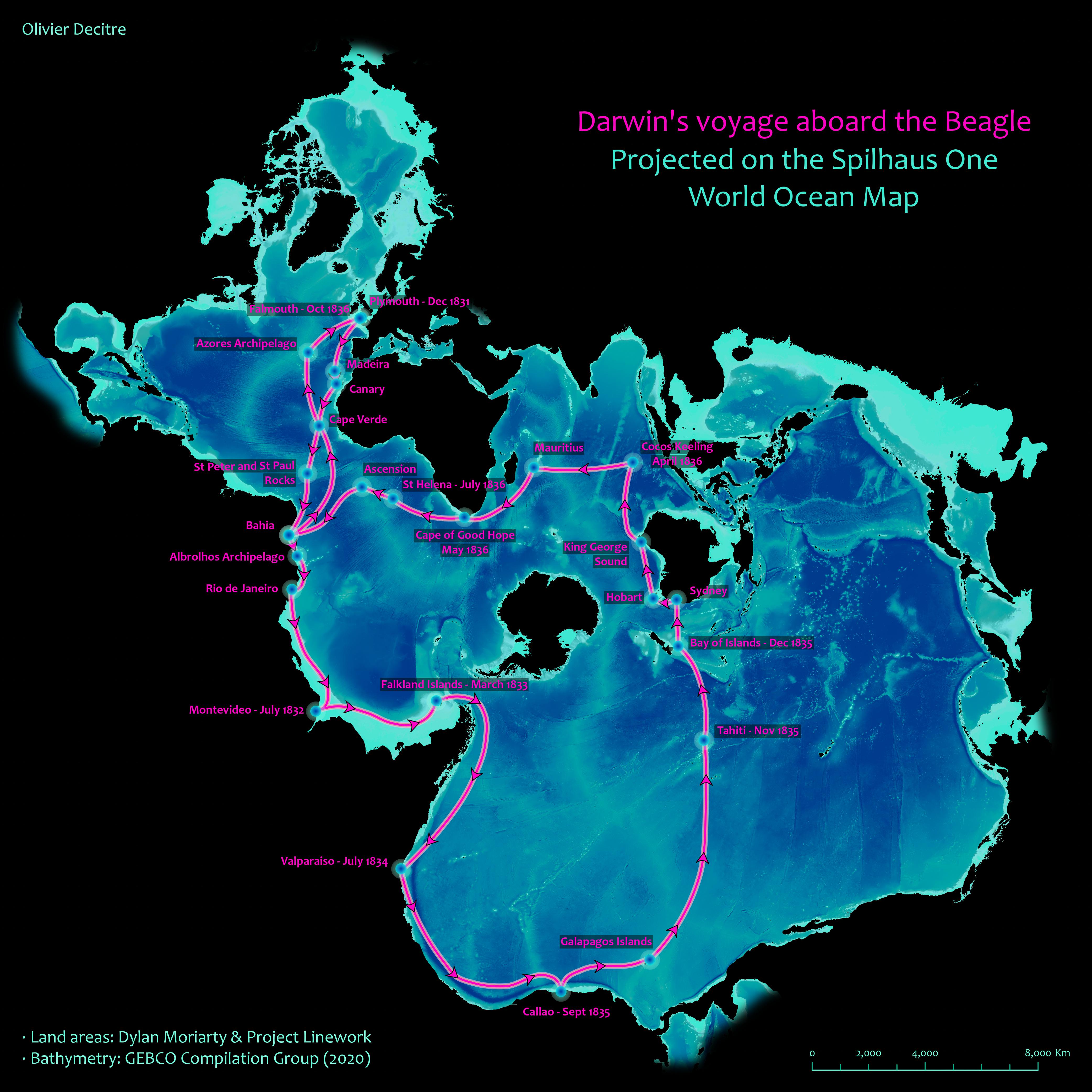
Custom Map Production
Professional cartographic design services for posters, reports, presentations, and publications. We create visually stunning, publication-ready maps that effectively communicate your spatial data.
From interactive web maps to high-resolution print layouts, our custom mapping solutions combine aesthetic design with technical accuracy to make your data shine in any format.