Showcased Projects
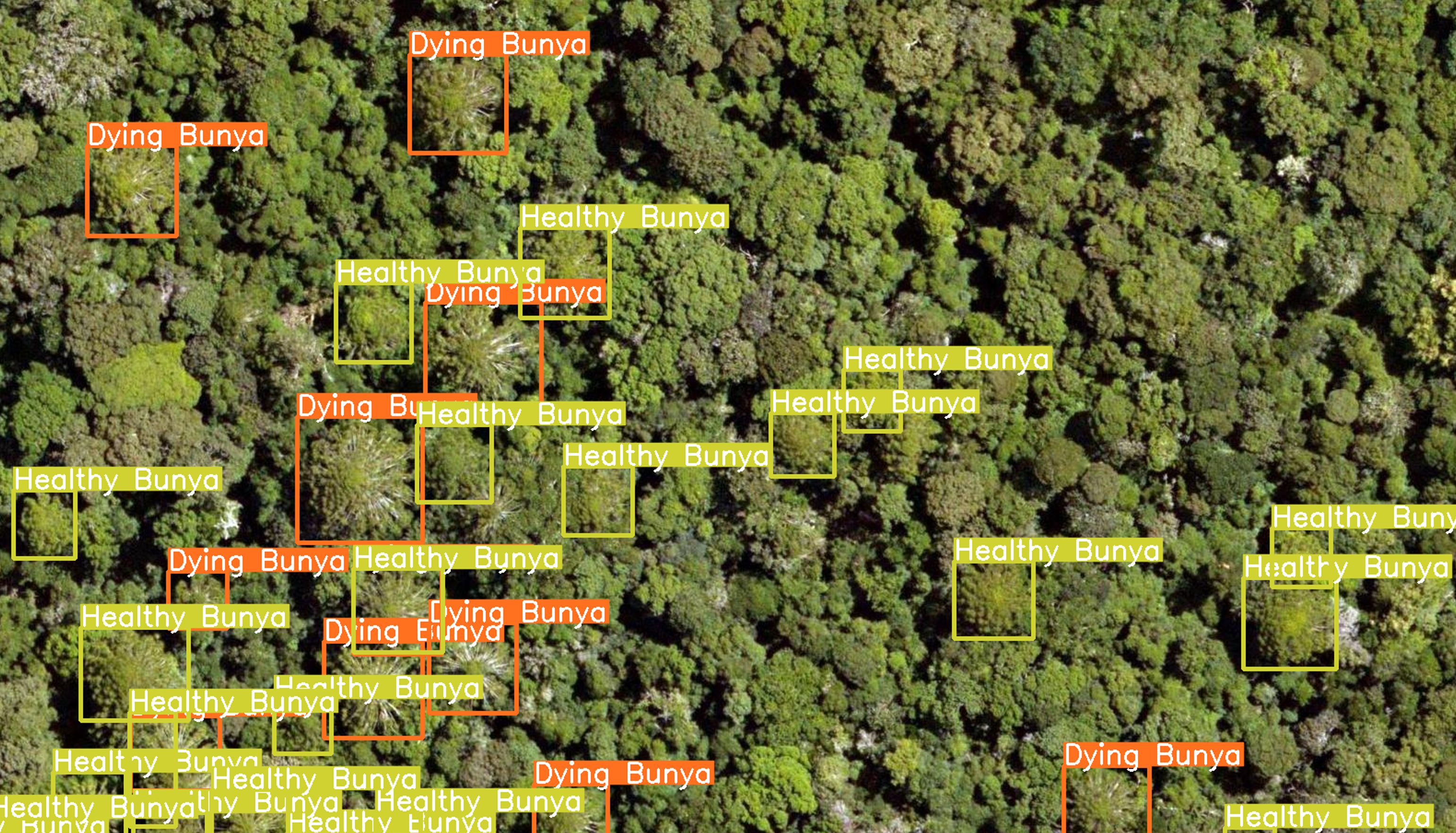
Mapping 35 000 Infected Pines over 600 hecatres using AI
Using object detection tools to survey culturally significant pines health in Bunya Mountains National Park
View Project →
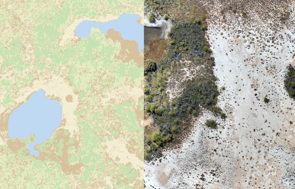
Mapping Vegetation in Western Australia from Drone Imagery
Using pixel-based classification and advanced analytics to establish a baseline survey of different land types including vegetation, shrubland, and barren earth
View Project →
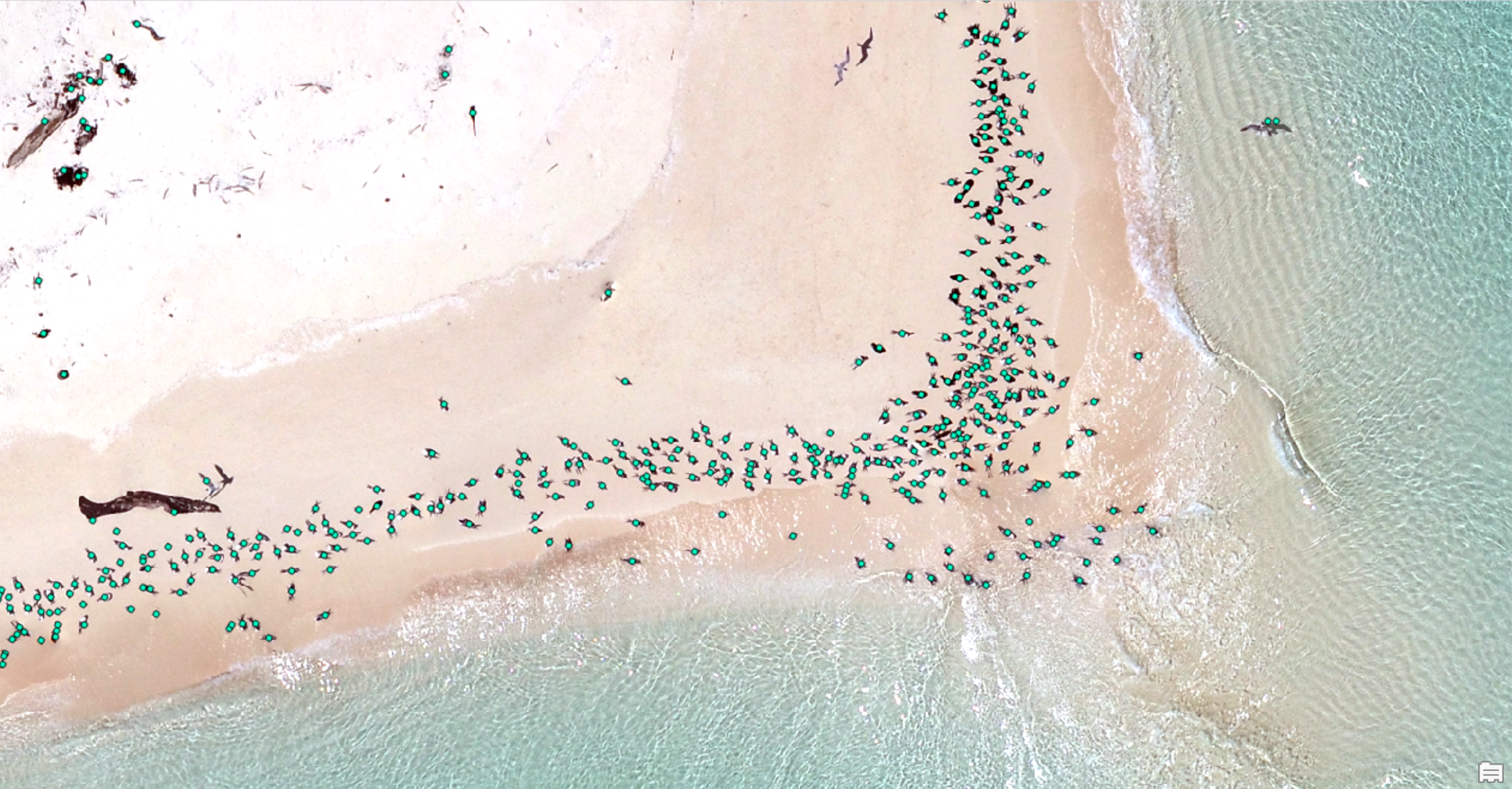
Mapping Change: Seabird Populations Through Time
Using AI to map over 40,000 seabirds across three aerial surveys from November 2022 to February 2023
View Project →
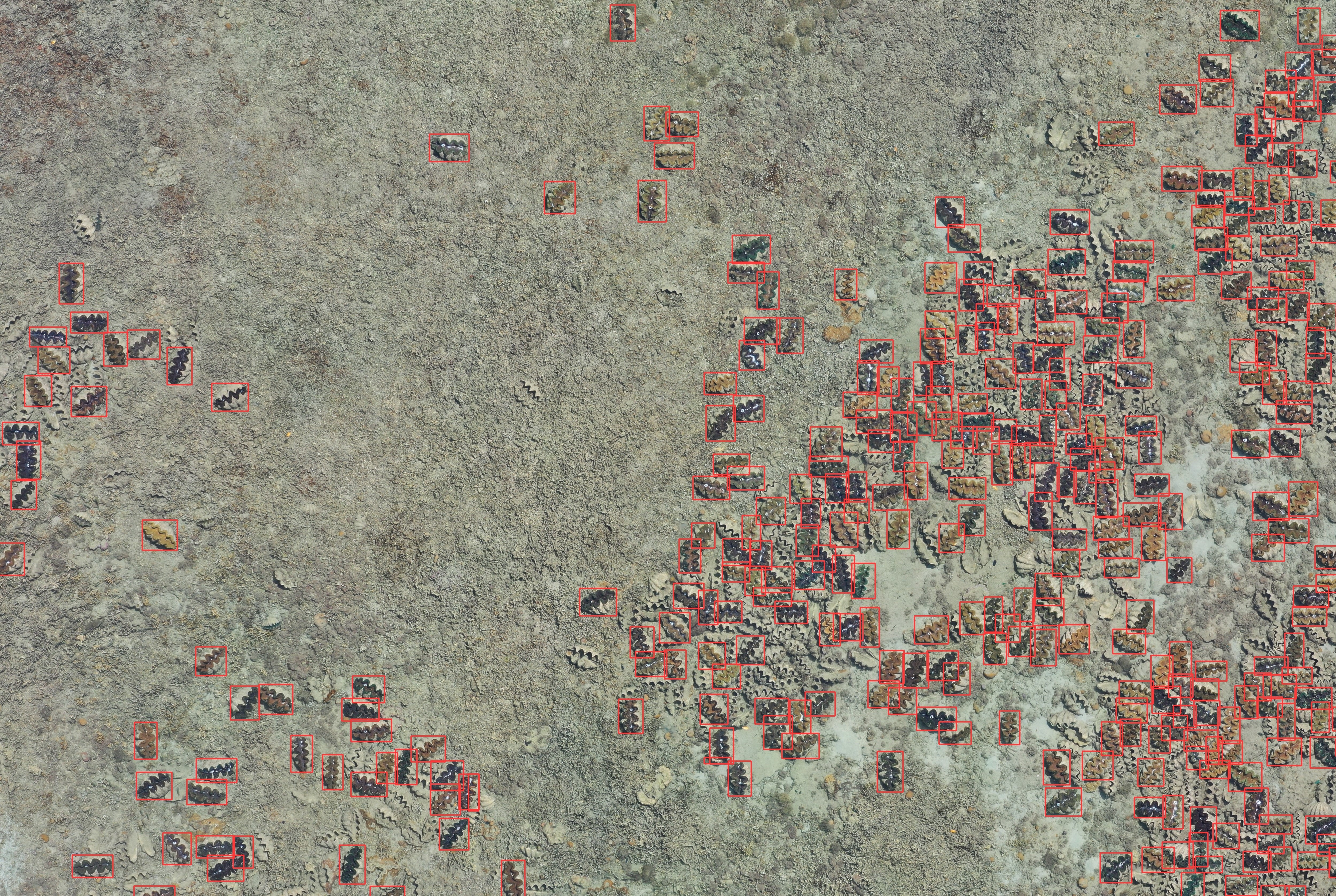
Mapping Giant Clams on the Great Barrier Reef with AI
Using Object Detection to map the location and distribution of Giant Clams on the Great Barrier Reef with aerial drone imagery
View Project →